(Print) Use this randomly generated list as your call list when playing the game. There is no need to say the BINGO column name. Place some kind of mark (like an X, a checkmark, a dot, tally mark, etc) on each cell as you announce it, to keep track. You can also cut out each item, place them in a bag and pull words from the bag.
1
2
3
4
5
6
7
8
9
10
11
12
13
14
15
16
17
18
19
20
21
22
23
24
25
26
27
28
29
30
31
32
33
34
35
36
37
38
39
these currents are driven by differences in density and salinity
deep currents
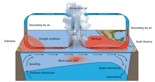
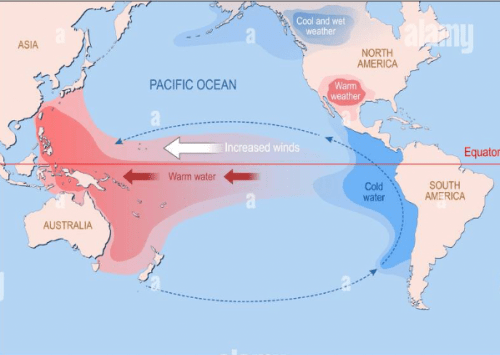
el niño
a piece of a cliff's edge falls into water below
gravity erosion
difference between high tide and low tide
tidal range
temperature changes create cracks in rocks
physical weathering
glaciers pick up and transport sediments as they move over land.
ice erosion
a river picks up sediments and carries them to the ocean
water erosion
hot, semi-solid rock underneath the crust
mantle
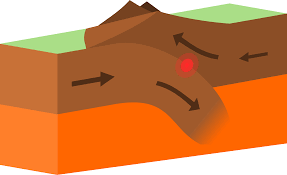
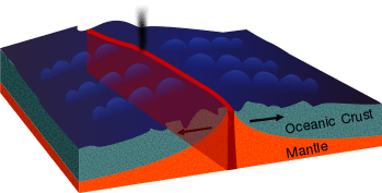
convergent boundary
this shore is resistant to weathering
rocky shore
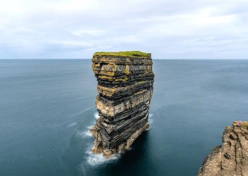
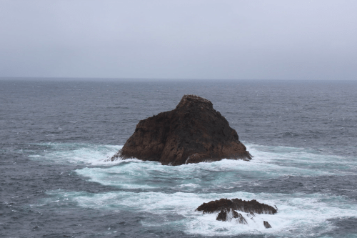
sea stack
occuring daily
diurnal
new rock exposed to precipitation dissolves ions and transports it to the ocean as runoff
chemical weathering
sun and moon align to create a larger tidal range
spring tide
lichen attach to balsaltic rock and break down particles.
organic weathering
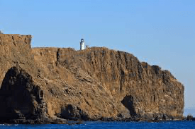
headland
la niña
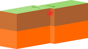
transform boundary
sediments are broken down, transported, and deposited in a nee place
sedimentation
sea stump
form at the mouth of a river where it meets the sra
delta
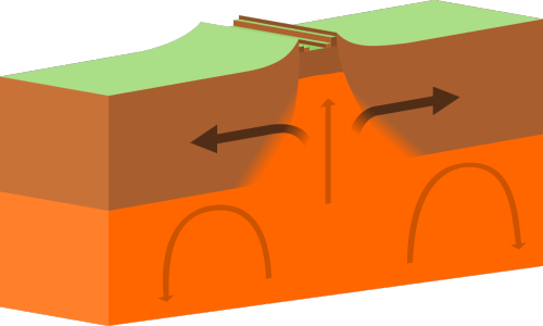
divergent boundary
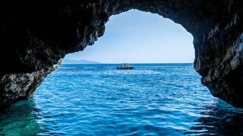
sea cave
the space between high and low tide
littoral zone
mid-ocean ridge
hot sphere of dense elements
core
earth's rotation causes currents to move clockwise in the northern hemisphere and counterclockwise in the southern hemisphere.
coriolis effect
occuring twice daily
semi-diurnal
continuous movement of water due to density or wind
current
regular rise and fall of the ocean surface due to the sun and moon's gravitacional pull
tide
outermost layer of the earth
lithosphere
these currents are driven by wind
surface currents
patterns of polarity and reversed polarity on the sea floor
paleomagnetic strips
form in sheltered areas where fresh and salt water meet
estuary
this shore is formed by erosion
sandy shore
sun and moon form a right angle with the earth to create a smaller tidal range
neap tide
this shore is shallow with no slope
muddy shore
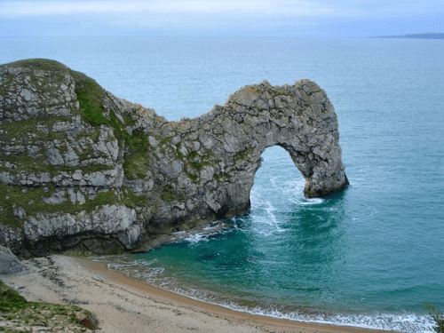
sea arch
wind picks up sediment and carries it to a new location
wind erosion